TALLER DE INVESTIGACIÓN
Linda Schilling
ALUMNOS
Christian Araneda
Pamela Bustamante
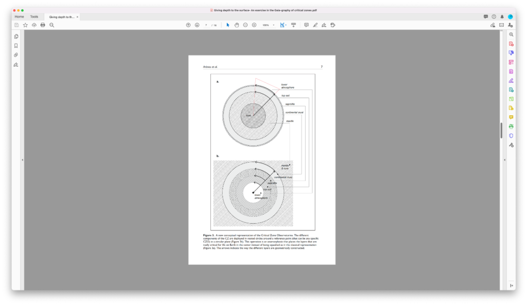
While in the planetary view to localize is to situate a point through longitude and latitude by applying a grid coming from outside (Debaise, 2017), the Gaia-graphic view creates a sideways representation of cycles the movement of which draws the membranes inside which we all reside.
Arènes, A., Latour, B., & Gaillardet, J. (2018). Giving depth to the surface: An exercise in the Gaia-graphy of critical zones. The Anthropocene Review, 5(2), 120–135
ANTECEDENTES
DESCRIPCIÓN
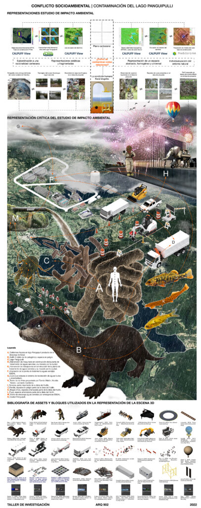
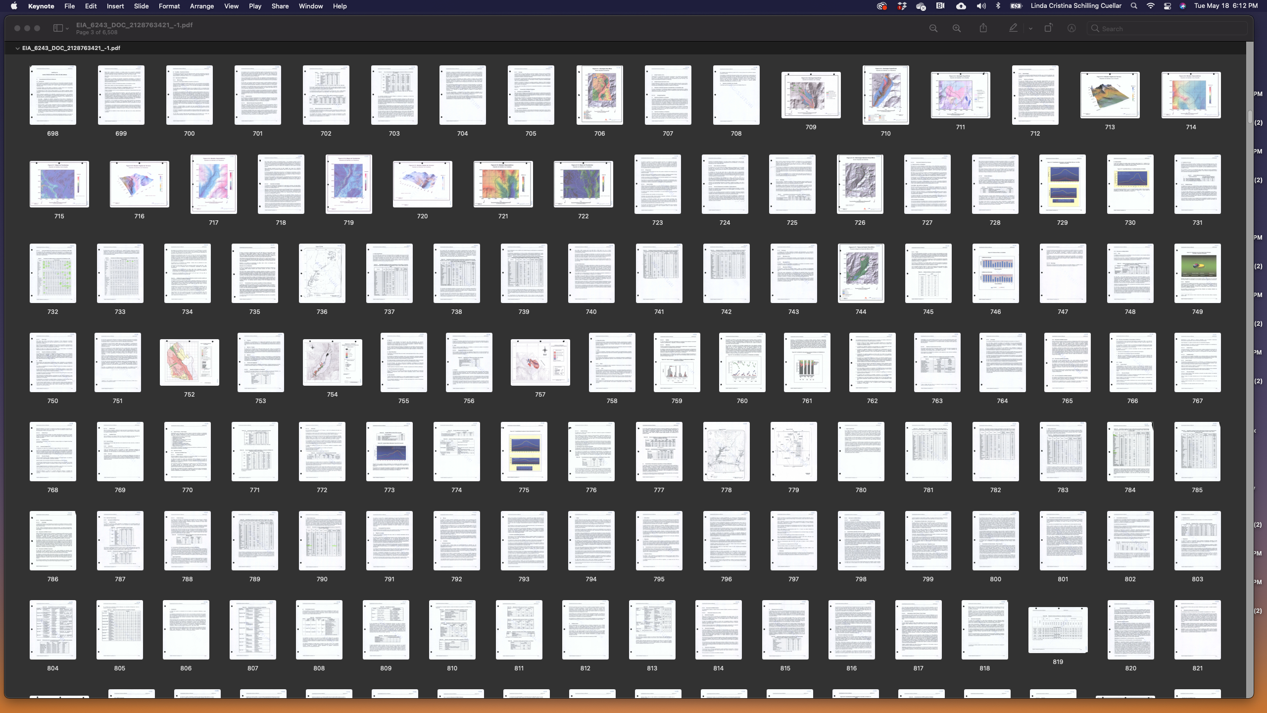
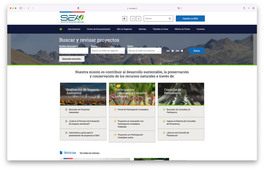
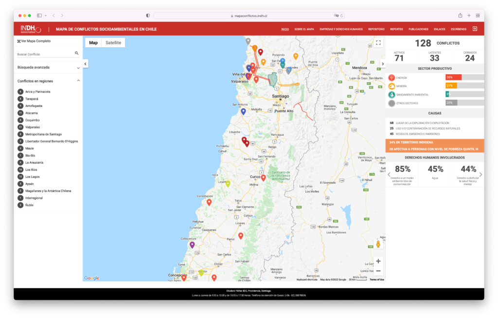
El taller se enfocará en la exploración del concepto “landscape ledger / cuadernos de paisaje”, el cual reconoce a los Estudios de Impacto Ambiental presentados por proyectos de infraestructura al SEIA, como un repositorio clave para estudiar las transformaciones del paisaje chileno mediante diversas técnicas de representación. Esta exploración contribuirá al desarrollo del Proyecto de Investigación “Territorios en Conflicto: Construcción de un contra relato de la arquitectura nacional en zonas de conflicto ambiental”, a través de la revisión de EIA en zonas de conflicto socio ambiental según el registro realizado por el Instituto Nacional de Derechos Humanos.
El objetivo del taller de investigación es introducir al alumno a la investigación a escalas de territorio utilizando como información instrumentos de gestión ambiental públicos promoviendo una mirada crítica respecto de aquello que compete a la disciplina. Esta distancia entre la disciplina y el territorio, la cual entiende a la arquitectura como un vehículo de acumulación de capital sin considerar sus repercusiones en el medio construido, es una perspectiva urgente por explorar en el contexto nacional cuando el relato ampliamente difundido es uno de progreso y desarrollo sin límites.
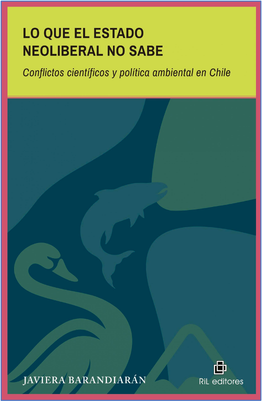
Hoy la sociedad chilena se encuentra re definiendo paradigmas, reconociendo la necesidad de justicia ambiental y reparaciones a comunidades expulsadas de sus territorios, discutiendo la incorporación de los derechos de la naturaleza en la nueva constitución, desafiando narrativas hegemónicas de progreso.
The studio focused on exploring the concept landscape ledger, which recognizes the Environmental Impact Studies presented by infrastructure projects in the SEIA, as a critical repository to study the transformations of the Chilean landscape through different representation techniques. This exploration will contribute to the development of the Research Project «Territories in Conflict: Construction of a counter-report of national architecture in areas of environmental conflict» through the review of the EIA in areas of socio-environmental conflict according to the registry made by the National Institute of Human rights. The studio aimed to introduce students to research at territorial scales using public instruments of environmental management as information, promoting a critical vision of what falls within the discipline. This distance between the field and the territory, which understands architecture as a vehicle for capital accumulation without considering its repercussions on the built environment, is an urgent perspective to explore in the national context when the widely disseminated narrative is one of limitless development. Today, Chilean society is redefining paradigms, recognizing the need for environmental justice and reparation for communities expelled from their territories, discussing incorporating the rights of nature into the new constitution, and challenging hegemonic narratives of progress.